It rained heavily through the night, but only puddles gave credence to
the nocturnal weather. The day dawned bright and with promise.
We hung about our spot on the canal, having agreed with Pam that we
would meet up and exchange contact details. We’d met up with her on the opposite
bank of the canal last night, sitting on a stool doing Sudoku puzzles while
fishing, the combination of cerebral and sports exercise. Her husband was
downstream fishing and pondering the matters of the world as is the case with
most leisure fishermen and did not notice us at all. We discussed motorhomes,
children, travel and retirement with Pam, who harked from Christchurch, but had
been on the road for about as long as us. We hit it off and could have stood in
the evening air chatting and swapping life stories for several hours but I knew
that Chris was keen to return to the camper to see how the cricket was coming
along. So we agreed that she would pop along in the morning since we were in no
hurry to leave. And so we hung about until after ten, and then popped along to
their motorhome ourselves thinking it rude to simply head away with no word,
but their blinds were still drawn, so we left without following through. A shame really because I liked her immensely
and I am sure her Graeme would have been as likeable; she was too forthright a
person to have suffered anyone less so.
The road south took us to Omarama, centre of the gliding universe if you
are to believe all the hype; the area’s northwest thermals being particularly
suitable for high altitude long flights, something we ourselves never
experienced when we dabbled briefly in the sport in Northland many years ago.
Apart from that fame, Omarama lies at the crossroads of the highway coming up
from Oamaru on the east coast and that running more or less north-south that we
were travelling.
We had called and lingered here before, staying at the DOC camp of the
Ahuriri River, another lovely braided river which at the right time was host to
a million Russell Lupins blooms. From here one can drive the short gravel road
to the Clay Cliffs, a bizarre moonscape resulting from two million years of
erosion of layers of silt and gravel exposed along the active Osler fault line.
The cliffs are on private land and the owner asks for a token donation at the
gate to “maintain the road”. Six or seven years ago it was obvious that the
donations were funding his holidays rather than any upkeep of the road; it
really was in an appalling state. Having said that, if it is the first time one
has come this way, the Clay Cliffs are certainly worth a visit.
But instead we found our way into the local Four Square store and came
out bearing a large Boston Bun which should, by volume, last us several days;
time will tell. We consumed one quarter with our morning coffee; I suspect the
next portions should be larger or it will grow stale!
From here we continued up the Ahuriri River, across flats strewn with
small rocks, yet harrowed for planting; we wondered at the state of the
machinery subjected to such materials. On the riverside of the road we saw
small cairns of stones, as we had on our last trip through. One wonders at the
builders; perhaps travelling children pausing for a break, filling the minutes
of their boredom, before the advent of iPads and such?
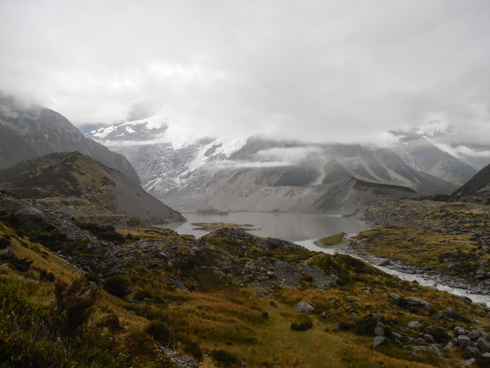
 The road passes up over the Lindis Pass, through dry steep barren
mountainous country, an elevation of 971 metres. We stopped at the lookout to
take a photo or three, and to check out the memorial. This is one dedicated to
not a Lord as that at Lake Pukaki, but to an Earl who gifted another scourge on
conservation; the red deer.
The road passes up over the Lindis Pass, through dry steep barren
mountainous country, an elevation of 971 metres. We stopped at the lookout to
take a photo or three, and to check out the memorial. This is one dedicated to
not a Lord as that at Lake Pukaki, but to an Earl who gifted another scourge on
conservation; the red deer.
In March 1871 the 11th Earl of Dalhousie of Brechin in
Scotland shipped seven deer to Dunedin which were liberated in the Lindis Pass
area after being shipped further to Oamaru, then transported over the pass by
bullock wagon. It is they who form the base of all the feral red deer who have
added to the decimation of the high country natural vegetation. God bless the
Earl!
The road south of the Pass is far steeper, more windy and slower, more
than we recalled. But then when I checked the elevations later, we should not
have been surprised. Omarama sits at an elevation of 420 metres ASL, the Lindis
Pass at 971 metres ASL and Tarras to the south where the land levels out into
the upper reaches of the Clutha River valley, sits at 268 metres ASL. Say no
more!
Tarras is an interesting spot, little more than a school and a
collection of shops that base their existence on the fame of Shrek, the hermit
merino sheep. Ah, the wonders of Shrek! This very woolly and long neglected
unshorn ram gained international fame in 2004. The story of how the shepherd
caught the sheep with the mammoth fleece that had avoided being shorn for six
years captured national, even international, attention. Media from around the
world reported on Shrek being shorn of his 22 kg fleece. Alas, under the weight
and glory of his coat, he was a scrawny nondescript. But he became the subject
of three books, and featured prominently in a fourth, and so we, New Zealand
residents in the main, equate the name of Tarras, with Shrek. In June 2011, a
the apparent age of sixteen, a very grand old age for a sheep, he died and was
mourned by the New Zealand public who had bothered to note his existence in the
first place.
In 2007, or whenever it was we passed through Tarras, we did stop and
visit the one shop to check out the souvenirs and left with none, far too tight
with our hard saved dollars. Today, had we bothered, we could have been more
discerning, checking out several in the little village that has grown out of
this amazingly quaint history.
Beyond Tarras, the road splits, right and west toward Wanaka and left
and east toward Cromwell. It was this second we took, having decided our route
this morning. From here one travels down river of the mighty Clutha which flows
from Lake Wanaka all the way to the sea, a distance of 338 kilometres, the second longest river in
New Zealand, and the longest in the South Island and the river of greatest
volume in the entire country. And it is near here that the river begins its
useful life as a generator of electricity, as so many South Island rivers do.
Near Bendigo, along Lake Dunstan, we pulled off and lunched. Again as so
oft before, I was enthralled by the fact that a great body of water can be
surrounded by such desolate dry country. This struck me in Australian when we
followed the Darling River and the Murray where irrigation was not prevalent;
it seems to defy the nature of the universe, that so much water can exist
adjacent to much parched land.
Cromwell is New Zealand’s town furthest from the sea, and has an annual
rainfall of 400 mm, a temperature range of -10 degrees Celsius to 37 degrees, on
average it snows three and a half days per year and frost arrives on 174 days
per year on average. Interestingly today, I February, patches of snow are
clearly visible on the Pisa Range immediately to the south of the lake.
The land hereabouts is considered semi-desert with tussock, scab-weed,
thyme and briar, a most uninviting group of plants. Wild flowers bloom in
spring and early summer, hence their absence now.
The Clutha valley is a basin lying between two elongated schist mountain
ranges, raised and tilted during the last five million years. Prominent are the
series of terraces formed by the rivers transporting gravel from the glaciers;
large landslides mantle much of the steeper slopes. The area is rich in mineral
deposits; so typical of such inhospitable land.
Cromwell is part of New Zealand’s gold mining history, the reason that
so many countries or areas of the world began their European settlement. But
that history also incorporates a more modern twist and so this is an evolved
(European) town.
Overlooking what was once the meeting of the waters of the Clutha and
Kawarau Rivers, The Junction, later renamed Cromwell, was sited here following
the Hartley and Reilly gold strikes in 1862. Early Maori hunters and traders,
and European explorers, surveyor and sheep-man had left its mark. It was
gold-mining which transformed the landscapes and it was the demands of the
miners for goods and services which gave birth to the town. When the rush
ended, farming and the coming of the railway ensured Cromwell’s survival.
Now largely under the lake, the main street of the old town once
extended from the bridge which spanned the river below the convergence of the
two rivers. Although the building of the Clyde Dam and the erection of Lake
Dunstan have meant drowned orchards and farmlands in the Cromwell Gorge and
much of the upper Clutha Valley, they have also opened the region to a new wave
of settlors and the growth of tourism.
 The old stone buildings still in use, the re-creation of part of the old
town in the Old Cromwell Historic Precinct, and the re-creation of a Chinese
mining community at the Mining Centre in the Kawarau Gorge are testament to the
spirit of the community.
The old stone buildings still in use, the re-creation of part of the old
town in the Old Cromwell Historic Precinct, and the re-creation of a Chinese
mining community at the Mining Centre in the Kawarau Gorge are testament to the
spirit of the community.
Robert Muldoon, Prime Minister from 1975 through to 1984, the Master of
Think Big Projects, promised that “The Clyde Dam will be the best things since
sliced bread!”
In 1976 the New Zealand Government approved the building of a Hydro Dam
at Clyde on the Clutha River. By 1992, the Clutha and Kawarau Rivers upstream from
the Clyde were flooded to form Lake Dunstan, providing water for the dam. The original
town of Cromwell at the junction of the two rivers was flooded.
An estimated 280 people lost their homes, some of whom had been in the
same family for generations, and although compensation was made, many never got
over the loss. Six farms and seventeen orchards were submerged or made
uneconomic. A further twenty five to thirty farms were affected. The creation
of Lake Dunstan flooded a total of 1,405 productive acres.
While there is no question that the dam has been able to provide much
needed electricity for the country, there have been concerns expressed about the
safety and on-going stability of the structure.
With the fault line running along the Clutha River bed, a “slip-joint”
was incorporated into the dam’s design to withstand any credible displacement which
may occur during an earthquake. Geological evidence dating back several hundred
thousand years shows some of the hillsides around Lake Dunstan are prone to
slippage. With over 14 kilometres of tunnels, sixty kilometres of surface
drilling and seventy eight kilometres of drainage holes, the slide areas have
been stabilised.
The survey pillars located through the Cromwell Gorge are markers for
measuring slip movement, Although unlikely, a slip of land into the lake could
cause a wave to flow over the top of the dam and flood the land beneath. A “backwash”
wave could cause some flooding in the gorge toward Cromwell.
For myself, with these facts and those gleaned from the information
centre when we were in Clyde some years ago, I would baulk at settling in Clyde
or even Alexandra! And that was before the Christchurch earthquake.
The area of the resulting lake is 26 square kilometres, the surface at
about 194 metres ASL, with a maximum depth of 60 metres. Like all such
developments, there are always positives and negatives and today watching
locals out water ski-ing and enjoying this manmade watery mass, it was hard to
find anything negative to say.
 The buildings in the old town were demolished and the land where they stood
contoured to form Lake Dunstan’s shore line and lake bed. In 1985 a group of
concerned Cromwell’s residents got together to save eight of the most important
historical buildings from the old town. These buildings are now part of the Old
Cromwell Town Historical precinct where we first headed on arrival. Old
Cromwell incorporated continues to reconstruct buildings from the old town to
create a unique historic precinct.
After wandering about enjoying many galleries and noting others enjoying
the cafes and restaurants, we agreed this was a delightful attraction for
tourists and locals alike. We scored a small bag of fresh cherries from one
gallery; the mother of the artists holding the fort and generous with an oversupply
of ripe fruit.
The buildings in the old town were demolished and the land where they stood
contoured to form Lake Dunstan’s shore line and lake bed. In 1985 a group of
concerned Cromwell’s residents got together to save eight of the most important
historical buildings from the old town. These buildings are now part of the Old
Cromwell Town Historical precinct where we first headed on arrival. Old
Cromwell incorporated continues to reconstruct buildings from the old town to
create a unique historic precinct.
After wandering about enjoying many galleries and noting others enjoying
the cafes and restaurants, we agreed this was a delightful attraction for
tourists and locals alike. We scored a small bag of fresh cherries from one
gallery; the mother of the artists holding the fort and generous with an oversupply
of ripe fruit.
After calling into the Information Centre, upgraded since we were last
here, but (wo)manned by equally helpful staff, we came north to this large
reserve on the western shore of Lake Dunstan where free-camping is tolerated if
not encouraged. I fed the local ducks with stale bread I had been reserving for
just such a purpose and then we settled down for a quiet late Sunday afternoon,
the sun still shining although the doomsayers on the weather channels keep
telling us to expect otherwise.
The road passes up over the Lindis Pass, through dry steep barren
mountainous country, an elevation of 971 metres. We stopped at the lookout to
take a photo or three, and to check out the memorial. This is one dedicated to
not a Lord as that at Lake Pukaki, but to an Earl who gifted another scourge on
conservation; the red deer.The old stone buildings still in use, the re-creation of part of the old
town in the Old Cromwell Historic Precinct, and the re-creation of a Chinese
mining community at the Mining Centre in the Kawarau Gorge are testament to the
spirit of the community.The buildings in the old town were demolished and the land where they stood
contoured to form Lake Dunstan’s shore line and lake bed. In 1985 a group of
concerned Cromwell’s residents got together to save eight of the most important
historical buildings from the old town. These buildings are now part of the Old
Cromwell Town Historical precinct where we first headed on arrival. Old
Cromwell incorporated continues to reconstruct buildings from the old town to
create a unique historic precinct.