Since last putting fingers to keyboard, we have managed a
more serious break, although hardly serious by our scale. This time it meant venturing
beyond a leisurely day’s distance from Whangarei but still remaining within the daughter-guilt
range; I am sure there will be some readers that understand this rather bizarre
measurement.


Then finally we set off on Auckland Anniversary Day, joining
the throngs heading back from the northern beaches in readiness for their
children’s school year to begin. We were disappointed that we were unable to
touch base with our youngest in West Auckland, but promised to remedy that on
our way home if possible.
 So with no social rendez-vous planned, we carried on through
Auckland and out to the eastern shores beyond Clevedon, to Kawakawa Bay still
on the edge of the Hauraki Gulf. There is a lovely spot at the northern end of
the main bay where one can picnic and enjoy the outlook, however Anniversary
Day was also an opportunity for all those from South Auckland who had not
headed to one of the city’s excellent Regional Parks to do the same. Alas there was little peaceful about the scene
on this particular day; a little like heading to the beach in Queensland on
Australia Day; perhaps that is a slight exaggeration.
So with no social rendez-vous planned, we carried on through
Auckland and out to the eastern shores beyond Clevedon, to Kawakawa Bay still
on the edge of the Hauraki Gulf. There is a lovely spot at the northern end of
the main bay where one can picnic and enjoy the outlook, however Anniversary
Day was also an opportunity for all those from South Auckland who had not
headed to one of the city’s excellent Regional Parks to do the same. Alas there was little peaceful about the scene
on this particular day; a little like heading to the beach in Queensland on
Australia Day; perhaps that is a slight exaggeration.

So we did not linger there but carried on down the
coastline, following the winding road up and over the hills and through lush
native bush, alongside rushing streams,
until we came down to the Firth of Thames, mussel farms laid out before
us as we reached Matingarahi. It is probably a couple of years since we have
travelled this road; the scenery is familiar but the massive amount of road
works was not. Evidence of erosion all along this road that hugs the coastline
all the way to Kaiaua was quite astounding; what a nightmare for those charged
with keeping the road open. In many places portable traffic lights were in use
to marshal the traffic into an orderly one way system, so we were not at all
inconvenienced although we might have been had we chosen this eastern route to
hasten our journey. It was obvious that much of the northbound traffic resulted
from conscious decisions to avoid the motorway south of Auckland.
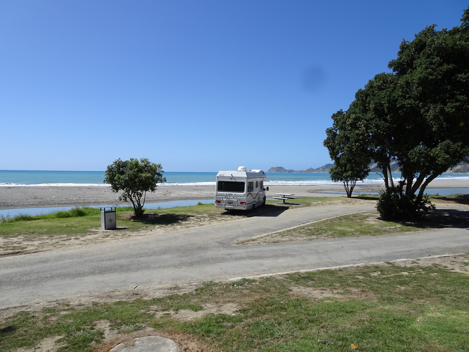
Just south of Kaiaua, we pulled into Rae’s Rest, a wonderful
camping spot for fully self-contained vehicles; there is nothing here but the
white sandy beach and the plethora of shore birds protected in this sanctuary.
We have stayed here on numerous occasions, listening to the gentle swish of the
tide as it changes, and one night some years ago treated to nature’s fireworks
display; a lightening extravaganza over the Coromandel Range just across the
Firth. As night fell we could see the lights of Thames far across the water and
the silhouette of the mountain range. We shared this lovely spot with a dozen
or more campers, some who braved the salty brine and some who preferred to
toast their bodies in the scorching afternoon sunshine. Since our last visit,
loads of seashells have been added to the parking space and finding a perfectly
level spot is not as easy as it used to be. I guess time and wear will
eventually sort that small problem out.
The next morning we headed away south again, soon passing
the Miranda Hot Pools where there is a lovely motor-camp for those who don’t
balk at paying commercial camping fees. Here one has the use of the lovely pool
complex as opposed to the plainer affair open to day-visitors, which does
justify some of the tariff.

 It’s less than an hour to Waihi Beach from here, travelling
on through Paeroa, then Waihi where we nearly always stop to buy groceries at
the very smart but small New World supermarket. At Waihi Beach we set ourselves
up at the RSA, booking in for a couple of nights in their car park. Alas the
Club has spent considerable money tarmacking the car park area where they
welcome motorhomers, and it has been contoured so that rainwater runs into the
centre and down into the revamped drainage system. While this is excellent from
a drainage perspective, it does little to please the motorhomer who seeks an
achievable level. Some of our fellows appeared to be set up at rather odd
angles; maybe they are not as particular as we are.
It’s less than an hour to Waihi Beach from here, travelling
on through Paeroa, then Waihi where we nearly always stop to buy groceries at
the very smart but small New World supermarket. At Waihi Beach we set ourselves
up at the RSA, booking in for a couple of nights in their car park. Alas the
Club has spent considerable money tarmacking the car park area where they
welcome motorhomers, and it has been contoured so that rainwater runs into the
centre and down into the revamped drainage system. While this is excellent from
a drainage perspective, it does little to please the motorhomer who seeks an
achievable level. Some of our fellows appeared to be set up at rather odd
angles; maybe they are not as particular as we are. We spent quite a bit of time with our daughter, her husband and son when they were not
working, but even teachers on holiday have to put in some hours at this late
stage of the school holidays, so we were left to our devises some of the time.
We used it sensibly, walking a couple of the tracks about the area. I had been
up to the Trig on an earlier visit but Chris had not, so this time we set off up
with Larissa and Sirius, the dog, on one of the hottest afternoons of this
summer, tackling the hill and many steps, but mostly in the shade of the native
bush and then the pine forest near the top.
We spent quite a bit of time with our daughter, her husband and son when they were not
working, but even teachers on holiday have to put in some hours at this late
stage of the school holidays, so we were left to our devises some of the time.
We used it sensibly, walking a couple of the tracks about the area. I had been
up to the Trig on an earlier visit but Chris had not, so this time we set off up
with Larissa and Sirius, the dog, on one of the hottest afternoons of this
summer, tackling the hill and many steps, but mostly in the shade of the native
bush and then the pine forest near the top.
The Trig walk is quite wonderful, although those with dodgy
knees or hips are best left down on the beach. The views from the top are just spectacular,
down the coast to Bowentown, across the Matakana Harbour to Mount Maunganui,
out to sea to Mayor Island, and of course below, the long strung out seaside
township of Waihi Beach. At a high point, above the Trig, there is a great tree
stump cut out as a giant’s seat, and we gathered about that to rest before
making the descent.
The following morning when we were left to our own devices,
we were encouraged to take Sirius with us when we informed the family we were
intending to undertake the Athenree Estuary walkway. This is a very flat walk
well patronised by cyclists, dog owners and walkers, in that order. Alas our
hearing is not very receptive to polite bell ringers, so we were nearly mowed
down a few times, which is all the more serious when one has a poorly trained
dog on a leash. However no one came to grief, and we enjoyed the birdlife on
the mudflats and that in the scrub along the track; herons and gulls, tuis and
swallows.
From Waihi Beach we travelled through to Tauranga calling on
a cousin on whom we have been promising to call for some years now. She and her
husband Brian are motorhomers like us, and like us have spent time travelling
around both the UK and our own country DownUnder. We spent a delightful
afternoon with Colette, and also found time to check out the coastal path at
Matua Peninsula starting from Fergusson Park.
It’s a real bonus to find a new attraction in a city or area you think
you know well, to prove that there is always something new under the sun.
 We walked toward the city centre along this pathway, the
mudflats revealed by the low tide starching toward the narrow channel that
separates Matakana Island from the mainland, and the deeper one separating
Mount Maunganui from Tauranga. Across the water, the port cranes stood tall,
although not as tall as the peak of Mount Maunganui itself.
We walked toward the city centre along this pathway, the
mudflats revealed by the low tide starching toward the narrow channel that
separates Matakana Island from the mainland, and the deeper one separating
Mount Maunganui from Tauranga. Across the water, the port cranes stood tall,
although not as tall as the peak of Mount Maunganui itself.
The coastal path passes some splendidly appointed homes, no
doubt sporting million dollar price tags when they change hands, but more
interesting were the places of historical interest along the way. Here can be
found the remains of Otumoetai Pa which was the most significantly populated
site in the Western Bay of Plenty between 1600 and 1865, its demise a result of
the New Zealand Wars of 1864 when the land was confiscated by the government.
Of course this is only part of the story and should only whet one’s appetite
for further research.
Here too are the sites of an old Catholic Mission and James
Farrow’s Trading Post, Farrow the first permanent trader in the Bay of Plenty
who traded Maori harvested flax for muskets and gunpowder from the 1830s. Later
when the flax trade declined, more nutritious commodities were traded; salted
pork, potatoes, wheat and maize.
I spent a few years living only kilometres from this part of
the city in the mid-1970s but knew none of this. I guess I had other interests
in those days….
 After staying the night at the NZMCA Park in Tauriko, we
pressed on along the Bay of Plenty coast, some of it on the “new” toll road
that bypasses Te Puke, and what an excellent road it is! We pulled into
Whakatane and wandered about the lovely CBD after chatting with an unlikely
looking local who had recently purchased a smart new motorhome and was
interested in where we had our tow-bar fitted. We learned that he was still a
couple of years off retiring and had borrowed rather heavily to finance his new
toy, much to the consternation of his more financially savvy children. But he
and his wife wanted to practice using their motorhome before they set off on
the road when he finally qualified for his hard earned pension. We were
inclined to sympathise with his children but then we all come from different
financial places and until one has walked in the shoes, one should not dare to
judge. (Although you will have noticed that I constantly do so!)
After staying the night at the NZMCA Park in Tauriko, we
pressed on along the Bay of Plenty coast, some of it on the “new” toll road
that bypasses Te Puke, and what an excellent road it is! We pulled into
Whakatane and wandered about the lovely CBD after chatting with an unlikely
looking local who had recently purchased a smart new motorhome and was
interested in where we had our tow-bar fitted. We learned that he was still a
couple of years off retiring and had borrowed rather heavily to finance his new
toy, much to the consternation of his more financially savvy children. But he
and his wife wanted to practice using their motorhome before they set off on
the road when he finally qualified for his hard earned pension. We were
inclined to sympathise with his children but then we all come from different
financial places and until one has walked in the shoes, one should not dare to
judge. (Although you will have noticed that I constantly do so!)
Continuing on around the shoreline, bypassing folk we should
have called on but had decided to do either on our return or on a subsequent trip,
we arrived at Opotiki, which makes for a poor sister settlement to Whakatane.
But then there is a very different population base here and the heydays of
Opotiki are long gone.
 We found our way to the new NZMCA Park here and joined the
many others who had sought out the same level of security as we did. From there
it is just a short walk up into what was once a thriving town.
We found our way to the new NZMCA Park here and joined the
many others who had sought out the same level of security as we did. From there
it is just a short walk up into what was once a thriving town.
Opotiki is the western gateway to Eastland so has captured
the tourist trade for some decades now, whether the traveller decides to take
the coastal route or the much shorter inland route across to Gisborne.


After centuries of itinerant and warring tribes up and down
the coast, the area was visited first by Captain James Cook in 1769, then in
the 19th century by traders and whalers from far across the sea. The
missionaries arrived and began the business of “civilising” the natives,
although in all fairness literacy always had to be a boon to any convert.
Through the mid-19th century there was fairly peaceful coexistence
between the Maori and the European settlors, the former inhabitants embracing
the European style of agriculture, but then through the 1860s came the Hauhau,
hangings and all the bloodiness that followed. Eventually things settled back
down and civilisation resumed, with it schools, banks, churches and hotels.
Some of these still stand, such as St Stephen’s Anglican Church, but most of
those that do are tired looking, reminders of yesteryears, with little hope of
tomorrow.
Having said that, the people of the area are now doing their
utmost to put some life into the place, developing cycle tracks to tempt the
most active and intrepid and providing basic services for those who do bother
to venture this way.
 Refuelled with diesel, water and fresh food, we set off
around the coast bright and early the day after arriving intending to travel
only as far as Te Kahu and stay in a Council blessed free camp just north of
the village centre, if it can be even called that. Chris and I have travelled
this coast twice before together, and separately once before, but I have to say
I had no memory of that south west of Te Kahu. It is quite lovely, with wide
open bays between each rugged headland, and with tidy marae complexes tucked into each of those bays. It was a
Saturday and as such a good day for the locals to be gathering at their meeting
places, giving evidence that community is still very important in these
semi-remote areas. At Torere, we passed a posse of about ten police cars, and
were overtaken by a patched Mongrel Mob motorcyclist, but otherwise there was
nothing to support the reputation that has plagued this area in the past.
Refuelled with diesel, water and fresh food, we set off
around the coast bright and early the day after arriving intending to travel
only as far as Te Kahu and stay in a Council blessed free camp just north of
the village centre, if it can be even called that. Chris and I have travelled
this coast twice before together, and separately once before, but I have to say
I had no memory of that south west of Te Kahu. It is quite lovely, with wide
open bays between each rugged headland, and with tidy marae complexes tucked into each of those bays. It was a
Saturday and as such a good day for the locals to be gathering at their meeting
places, giving evidence that community is still very important in these
semi-remote areas. At Torere, we passed a posse of about ten police cars, and
were overtaken by a patched Mongrel Mob motorcyclist, but otherwise there was
nothing to support the reputation that has plagued this area in the past. We crossed the bridge over the Motu River after travelling a
few kilometres up the gorge and enjoyed the incredibly picturesque scenery
immediately about us. This river is a surprising 110 kilometres long and rises
487 metres above sea level. Years ago we
drove “The Motu” in a car, a very rough road through the rugged interior which
required some repair along the way; we were able to do this with a few fallen
logs and breath holding as we crossed our rudimentary bridge. It is not a road
to be taken in much more than a 4WD and certainly in nothing like our current
motorhome!
We crossed the bridge over the Motu River after travelling a
few kilometres up the gorge and enjoyed the incredibly picturesque scenery
immediately about us. This river is a surprising 110 kilometres long and rises
487 metres above sea level. Years ago we
drove “The Motu” in a car, a very rough road through the rugged interior which
required some repair along the way; we were able to do this with a few fallen
logs and breath holding as we crossed our rudimentary bridge. It is not a road
to be taken in much more than a 4WD and certainly in nothing like our current
motorhome!
At Te Kahu we dumped in anticipation of our overnight camp,
paying the required $5 to the commercial camping ground to use their facility.
While it is years since we have had to resort to using (and paying) for this
service, we acknowledged the fee has remained at the same level for the past
twenty years, and is fair enough.
 Alas when we pulled on to the reserve and checked out the
small area allocated to self-contained motorhome campers, we were unable to
find any space that was near enough level, even using all our levelling blocks,
so instead decided to press on again after lunch. It really is a delightful
spot as will be attested by those others who managed to arrive before we did,
and especially the owner of the very large bus-car rig who parked sideways
taking up about three spaces. We watched tractors come and go as they launched
their fishing boats, some of these old ex-agricultural vehicles held together
with bailing twine and very little else. There were plenty of swimmers enjoying
the apparently safe bay but we were satisfied to just wander about and observe.
Alas when we pulled on to the reserve and checked out the
small area allocated to self-contained motorhome campers, we were unable to
find any space that was near enough level, even using all our levelling blocks,
so instead decided to press on again after lunch. It really is a delightful
spot as will be attested by those others who managed to arrive before we did,
and especially the owner of the very large bus-car rig who parked sideways
taking up about three spaces. We watched tractors come and go as they launched
their fishing boats, some of these old ex-agricultural vehicles held together
with bailing twine and very little else. There were plenty of swimmers enjoying
the apparently safe bay but we were satisfied to just wander about and observe.
 East (and north) of Te Kahu , the bays are more intimate and
rocky, offering less access but more appeal. Over Christmas they must be even
more of a treat, when the pohutukawa trees are in full bloom. At Raukokore, we
pulled onto the roadside to join twenty or more motorcyclists, this lot of the
Ulysses Club variety, and checked out the charming Anglican old church which
stands on the promontory. Years ago we called in here and were greeted by
unfamiliar smells which were explained by a notice introducing us to the
penguins nesting under the floor boards. This time the smell had gone but a
little family of stuffed knitted penguins gracing the rail at the entrance
support the remaining sign.
East (and north) of Te Kahu , the bays are more intimate and
rocky, offering less access but more appeal. Over Christmas they must be even
more of a treat, when the pohutukawa trees are in full bloom. At Raukokore, we
pulled onto the roadside to join twenty or more motorcyclists, this lot of the
Ulysses Club variety, and checked out the charming Anglican old church which
stands on the promontory. Years ago we called in here and were greeted by
unfamiliar smells which were explained by a notice introducing us to the
penguins nesting under the floor boards. This time the smell had gone but a
little family of stuffed knitted penguins gracing the rail at the entrance
support the remaining sign.
Access to the lovely bays along this coast is mostly through
private land and while there are directions and contact details for those from
whom permission should be obtained, one would have to be quite keen to bother.
We satisfied ourselves with the drive-by. And once we reached Whangaparaoa, the
road headed east and inland, much bordered by the scars of milled pines.
 Thirty three kilometres after leaving the coast, we arrived
at Hicks Bay where there is evidence again of bygone activity, prosperity
unlikely to be replaced even by the tourist trade. We had spotted a few signs
saying “No Port here” in the same way one finds “No Mining here” in the
Coromandel. This suggested to me that there is a move to have the timber being
milled right through the area to be shipped out rather than transported out by
the many logging trucks we were soon to encounter. Once these areas, from Hicks
Bay down to Gisborne had abattoirs and wharves that welcomed shipping trade and
transport. Now the abattoirs are crumbling concrete shells, relics of lost
prosperity. And with greater distance to abattoirs, it must be a lot more
costly to transport livestock out to those that do remain, costs that kill
profits. It is from here at Hicks Bay and onwards that the large sheep and
cattle stations exist, or did in better times if they are not now reverting
back to native bush and scrub.
Thirty three kilometres after leaving the coast, we arrived
at Hicks Bay where there is evidence again of bygone activity, prosperity
unlikely to be replaced even by the tourist trade. We had spotted a few signs
saying “No Port here” in the same way one finds “No Mining here” in the
Coromandel. This suggested to me that there is a move to have the timber being
milled right through the area to be shipped out rather than transported out by
the many logging trucks we were soon to encounter. Once these areas, from Hicks
Bay down to Gisborne had abattoirs and wharves that welcomed shipping trade and
transport. Now the abattoirs are crumbling concrete shells, relics of lost
prosperity. And with greater distance to abattoirs, it must be a lot more
costly to transport livestock out to those that do remain, costs that kill
profits. It is from here at Hicks Bay and onwards that the large sheep and
cattle stations exist, or did in better times if they are not now reverting
back to native bush and scrub. Nine kilometres on is Te Araroa, a wide bay with more
services than anything since Opotiki, but still hardly enough to warrant the
moniker “township”. Here is a long beach piled high with driftwood, even more
than others passed along the route, a small grocery store, an expensive fuel
outlet, a school and another NZMCA Park where we set up for the night. This one
is very new, the plantings barely out of their nursery pots and has nothing but
a flat surface and lock on the gate to offer security.
Nine kilometres on is Te Araroa, a wide bay with more
services than anything since Opotiki, but still hardly enough to warrant the
moniker “township”. Here is a long beach piled high with driftwood, even more
than others passed along the route, a small grocery store, an expensive fuel
outlet, a school and another NZMCA Park where we set up for the night. This one
is very new, the plantings barely out of their nursery pots and has nothing but
a flat surface and lock on the gate to offer security. The next morning we woke to a lovely view back up into the
hills and the promise of yet another superb day. Our written guides suggested
that the best time to visit the lighthouse on the Cape was before sunrise, but
we had still been abed; after breakfast would have to do.
The next morning we woke to a lovely view back up into the
hills and the promise of yet another superb day. Our written guides suggested
that the best time to visit the lighthouse on the Cape was before sunrise, but
we had still been abed; after breakfast would have to do.
 |
| Add caption |
The East Cape lighthouse was originally erected in 1900 out on East Island just offshore, but
after years of earthquakes and subsequent erosion, it was decided to relocate it
in 1922 to this hill at the end of the Cape. The cast iron tower stands 14
metres high, and the light which flashes every ten seconds, can be seen for 19
nautical miles. The light was fully automated in 1985 and the lighthouse keeper
out of a job, as has happened all around the country, and no doubt all around
the world. I guess there are not too many ex-lighthouse keepers left but there
are probably an awful lot of grownup children who spent their early years in
remote places such as this.
We pulled off the road on the way back, and spent a good
part of the day just enjoying the sea raging on the flat rocks below us,
reading the weekend paper and the last of our library books, the stock of which
was quickly dwindling.
 Back at Te Araroa, we wandered along to check out the giant
pohutukawa tree, reputed to be the oldest and largest in New Zealand,
supposedly over 350 years old and standing in excess of 21.2 metres tall,
measuring 40 metres at its widest point. It is so massive and complex it is
impossible to gauge if it has grown since we last checked it out. That too must
be quite a picture at Christmas time.
Back at Te Araroa, we wandered along to check out the giant
pohutukawa tree, reputed to be the oldest and largest in New Zealand,
supposedly over 350 years old and standing in excess of 21.2 metres tall,
measuring 40 metres at its widest point. It is so massive and complex it is
impossible to gauge if it has grown since we last checked it out. That too must
be quite a picture at Christmas time. The following morning we headed south across more scarred
forestry land, coming down toward the Pacific Coast at Tikitiki, then staying
inland as we continued on past the turn off to Ruatoria, once notorious as a
den of crime, now location of the first New Zealand company to secure a license to cultivate medicinal cannabis.
The following morning we headed south across more scarred
forestry land, coming down toward the Pacific Coast at Tikitiki, then staying
inland as we continued on past the turn off to Ruatoria, once notorious as a
den of crime, now location of the first New Zealand company to secure a license to cultivate medicinal cannabis.
We had thought we might stop at Te Puia and have a swim in
the hot pools there, as we did many years ago. In more recent years the hotel
and the pools have been revamped which has no doubt been a good reason to up
the price for a little dip. At $10 a head we thought it too much for a half
hour or less in thermal water although I would have been happy enough paying
three quarters of that; Chris not at all. So it was just as well we did not
have to debate this matter further but instead pressed on down to the coast emerging
at lovely Tokomaru Bay, yet another once-upon-a-time town. It does seem to
offer more than Te Araroa by way of commercial enterprise, and the seaside
reserve and facilities are most attractive. We parked up and lunched, Chris
having a wee snooze while I wandered about the old part of the town and across
the river.

 We had called into the Council Information office at Te Puia,
to follow up on a matter discussed with the people in the information office at
Opotiki a few days ago, this the camping permit offered by the Gisborne
District Council during the summer months in specially allocated sites,
starting from Tokomaru Bay and all along the coast as one comes on down to Gisborne. At first glance it seems such a brilliant
idea – permission and a rubbish bag for a series of options, the smallest being
for two nights, the longest 28 days; $16.50 to $71.50 respectively. There is a
long list of rules but mostly they are just matters of common sense health,
safety and common courtesy, but the problem we have with the system is that
offers little flexibility. The specific site must be selected for specific
dates, which does not suit freedom campers in the true sense; we do not know
for sure where we will be on any specific day, although I do acknowledge we had
to conform to the rule when in the UK.
We had thought it might be nice to camp at Tokomaru Bay and then after
Gisborne, Doneraille Park further south, but we did not exactly know which
nights we would be there. As it turned out, it was just as well we did not go
down this track because of having to abort our plans.
We had called into the Council Information office at Te Puia,
to follow up on a matter discussed with the people in the information office at
Opotiki a few days ago, this the camping permit offered by the Gisborne
District Council during the summer months in specially allocated sites,
starting from Tokomaru Bay and all along the coast as one comes on down to Gisborne. At first glance it seems such a brilliant
idea – permission and a rubbish bag for a series of options, the smallest being
for two nights, the longest 28 days; $16.50 to $71.50 respectively. There is a
long list of rules but mostly they are just matters of common sense health,
safety and common courtesy, but the problem we have with the system is that
offers little flexibility. The specific site must be selected for specific
dates, which does not suit freedom campers in the true sense; we do not know
for sure where we will be on any specific day, although I do acknowledge we had
to conform to the rule when in the UK.
We had thought it might be nice to camp at Tokomaru Bay and then after
Gisborne, Doneraille Park further south, but we did not exactly know which
nights we would be there. As it turned out, it was just as well we did not go
down this track because of having to abort our plans.
The other crazy thing is that you can go online to apply for
the permit and they will post it out to you within so many days – what good is
that? However there are places along the route you can purchase the permit over
the counter, and the Te Puia office was one such. I would suggest this permit
arrangement is best suited for those who go to one place for several days, or a
week, normally a relatively local person or family, and not for the
freewheeling tourist.
Instead when we arrived at Tolaga Bay, after checking out
the free camping area, we decided to park up beside George & Mildred’s
Supermarket, Thelma offering members of the NZMCA a relatively level and clear
site for the modest fee of $5. Perhaps the location could be considered dodgy
on benefit night, or over a weekend, but it was a Monday night and we figured
that the good would spend their night sleeping and the bad were still sleeping
off the effect of the weekend.
 Tolaga Bay is of significant size and while having little to
offer but food and fuel, it does have the feel
of civilisation, and it is after all, only 55 kilometres from
Gisborne. The name of the place seems to
be a mystery because there is no bearing to its Maori name of Uawa, and has no
relevance to any European who happened upon the place in the early days,
however Tolaga Bay it has remained. I did read one explanation; that Tolaga may have been a misinterpretation
for the word te raki referring to a
north wind blowing into the bay, but it sounds a bit tenuous to me.
Tolaga Bay is of significant size and while having little to
offer but food and fuel, it does have the feel
of civilisation, and it is after all, only 55 kilometres from
Gisborne. The name of the place seems to
be a mystery because there is no bearing to its Maori name of Uawa, and has no
relevance to any European who happened upon the place in the early days,
however Tolaga Bay it has remained. I did read one explanation; that Tolaga may have been a misinterpretation
for the word te raki referring to a
north wind blowing into the bay, but it sounds a bit tenuous to me.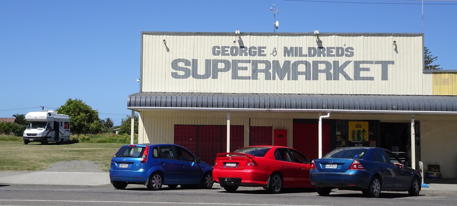
Back in the day, here too was an abattoir and more importantly a significant wharf to accommodate the ships that came in. Sheep were introduced to the region in 1863 and have remained an important part of life here ever since. In the early years of the land clearing, and establishment of the sheep and cattle stations, sea transport was the only efficient means of transporting produce away from the region. Initially small wharves in the Uawa River were used as loading out points for small boats carrying cargo to larger boats moored in deeper water. However as quantities grew this became very inefficient and an alternative solution was sought.
By
1875, Tolaga Bay was the largest European settlement on the East Coast, and the
local port, that had begun its life servicing flax and whale traders, quickly
developed into a critical component of the farming business that had grown up
around the regon.
In
other places along the coast, a surf landing service was used to load cargo,
which sounds very dodgy from this end of history. Here in Tolaga Bay port
matters were a little more formal with the construction of the Hauiti Wharf up
the river. But silting problems from inland floods restricted the use of the
wharf and other remedies were considered including the use of Cooks Cove , more
of this place later.
The
political discussions regarding the establishment of an open sea wharf arose
after the First World War, helped along by post-war resettlement of veterans,
and in 1920 the newly formed Tolaga Bay Harbour Board decided to approach the
Minister of Marine for recommendation of a suitable engineer to report on
required harbour works, and so the slow process of bureaucracy began.
Cyrus Williams was the lucky man to be appointed to design
and control the proposed construction works, and after tenders were invited,
the contract to construct the 660 metre long wharf was awarded to Gisborne
based contractor, Frederick Goodman, in 1924. Work started the next year and
continued intermittently until 1929 when the entire structure was completed. At
the time its completion was considered a technological and engineering feat of
gargantuan proportions; never before had such a large and audacious project
been attempted in an open and particularly hostile marine environment.
Obviously the completion of such an amenity changed life in the area. Records show that the busiest year for the wharf was in 1936 when 132 vessels visited Tolaga Bay. But global carryings on soon changed the glory years; the Great Depression of the 1930s effected primary industries such as pastoral vessels visiting, and then came World War II. By the end of the war the roads had improved significantly and there was no longer such reliance on the wharf. Less trade through the wharf removed maintenance funds and in by the mid-1960s the cost of shipping produce out of Tolaga Bay exceeded trucking costs. In 1968 the port was closed to shipping.
The
wharf remained a tourist attraction but directly generated no income, thus damage
by the elements slowly eroded the structure of the wharf until such a point
there was a call for major restoration. At a cost of five and a half million
dollars, the work was carried out in three stages, the first completed in the
summer of 2001-02 by an outfit from Tauranga, and the second and ongoing
maintenance by an Australian contractor, the second phase completed in 2006.
Signs explain the complexity of the work in an attempt to justify the cost, all
paid for by the Tolaga Bay Save the Wharf Charitable Trust who launced what was probably the biggest fundraising
campaign, per head of population, the country’s history. None of this is
appreciated to the level it should be by the tourists who venture out to walk it’s
length or those who fish from the end. Nor, I suspect, does the investment in
the restoration even begin to be justified by the income these visitors bring
into the town; the odd icecream, a loaf of bread, a bag of fish bait? Still I
suppose the same could be said for many such works of restoration, especially
in places of low population like New Zealand.
We
checked the wharf out ourselves that afternoon we arrived, then gave the little
town the onece over while eating icecreams, before settling in beside George
& Mildred’s. The next morning we got away promptly returning to a spot neat
the whar from where one can set off on one of the area’s loveliest walks.
 The
Cook’s Cove Walkway is a two and a half
walk up through farmland, then steeply down through manuka bush to an abosolute
gem of a cove, one that Captain James Cook found refuge in 1769. Here he and
his crew hauled their ship, the Endeavour , ashore and cleaned two years of
weed and barnacles from its hull. Here too they were able to restock their
water and fresh food supplies. To the north of the cove, there is a natural
hole in the rock cliff giving one a framed view of the open sea; a depiction of this scene painted at the time
is shown on the interpretative panel in the cover. Little but the vegetation
has changed over the almost 250 years.
The
Cook’s Cove Walkway is a two and a half
walk up through farmland, then steeply down through manuka bush to an abosolute
gem of a cove, one that Captain James Cook found refuge in 1769. Here he and
his crew hauled their ship, the Endeavour , ashore and cleaned two years of
weed and barnacles from its hull. Here too they were able to restock their
water and fresh food supplies. To the north of the cove, there is a natural
hole in the rock cliff giving one a framed view of the open sea; a depiction of this scene painted at the time
is shown on the interpretative panel in the cover. Little but the vegetation
has changed over the almost 250 years.
Here
on the walk we encountered John from Ruatoria, a man with a smooth complexion
belying his years and his lifetime occupation as shearer. We spoke of the maunga (mountains) of the
area to the north; the North Island’s highest non-volcanic peak of Mt Hikurangi
at 1754 metres, and the surrounding maunga
of Aorangi, Komapara, Aoparauri, Raukumara and Pungarehunui to name only those
over 1000 metres. We spoke of erosion and forestry, and the juxtaposition of
the two.

 We
left John fairly early on the track, even though he was so obviously fitter
than we were despite his relatively recent knee replacements. Later we
encountered other walkers who we encouraged to walk to the very end of the
trail, and others, foreign and obvioulsy time poor, just up to the lookout over
the cove about half the distance. We decided the route was much changed from
that we walked twenty four years ago, more strenuous but probably offering more
options for shortening and certainly offering more in the way of seating and
viewing platforms.
We
left John fairly early on the track, even though he was so obviously fitter
than we were despite his relatively recent knee replacements. Later we
encountered other walkers who we encouraged to walk to the very end of the
trail, and others, foreign and obvioulsy time poor, just up to the lookout over
the cove about half the distance. We decided the route was much changed from
that we walked twenty four years ago, more strenuous but probably offering more
options for shortening and certainly offering more in the way of seating and
viewing platforms.
Back
in the camper, a little before midday, we headed south again, and travelled
through far more civilised countryside (if one considers evidence of serious
farming practices as civilised), steep inland geography; we emerged once more
to the castline at Pouawa, the site of one of these Council campsites and the
most southern extent of the Te Tapuwae O Rongokako Marine Reserve and the
equally protected sand dunes. Here we parked up and lunched, with the sound and
distracton of dozens of logging trucks heading toward the port at Gisborne.
And
then we went on again, soon approaching the one and only seriously populated
place in Eastland, joining the queues of slow traffic causing mayhem with
flying chip metal. The road had been recently sealed but the contractors had
done an appalling job, and the rain of stones, upon the underside of the vehicles
and flying at our windscreen, invited insurance claims and irate road rage.
Arriving
beyond the worst of the stone-blizzard, we checked out the beach to the north
of the city and the Taruheru River which forms the eastern boundary of the main
city. Kaiti Hill sits above that entry route, and over the massive log storage
yards, and more importantly for the campers arriving in the city looking for a
free place to park their wheels, Kaiti Beach. We found this a most attractive
and desirable place to stop over, but were also keen to go out to dinner and
the walking distance from here to the middle of the CBD, ignoring the precise
location of any would-be dining destinations; this would not suit. Instead we
found our way to the Cosmopolitan Club, a place we had stayed some years ago,
offering NZMCA members a secure park over spot, and their club facilties. We
paid the requested $10 for the privelege of such convenient and secure overnight
parking, and then without feeling any obligation to patronise the club, given
we had paid a “camping” fee, walked out into the city early in the evening to
dine at Bollywood Star, an Indian restaurant (of course) offering beautiful,
bountiful and well priced meals.
The
next morning while we dealt with household matters; dumping and laundry in a
rather dubious suburb, we learned my mother had activated her St John’s call
out alert and was in hospital. We completed our laundry task in an excellent
little laundromat, shared with a Mongrel Mob patched mongrel who was there
doing his washing with his two little children, conversing in the foulest
language with a fellow mongrel. I wondered about those children; what kind of
future could they hope for?
Over
lunch after refilling with water and dumping our waste, we decided to abandon
our travel plans to head further south along the coast to Wairoa, Napier, then
up through Taupo, Rotorua and Hamilton, calling upon friends and family along
the way, and head for home where we were needed.
Our route took us back up to Opotiki, this time up through the wine producing valley immediately north of Gisborne, reputedly the Chardonnay Capital of the World, on up through the land of the Tuhoe, through the Waioeka Gorge, this latter a fifty kilometre steep, narrow and extremely beautiful drive through bush and rugged terrain. The gorge cuts through ranges of steep sided hills rising from 400 metres near the coast to 1000 metres inland.
Through
here since the 1890s, people have attempted to farm the Waioeka but a combination
of depression, falling prices ad extensive erosion forced many to abandon their
farms. By the late 20th century, the government progressively added
retired farmland to the Waioeka Gorge Scenic Reserve to protect water
catchments. Regenerating bush helped reduce erosion, improve water quality and
protect the Opotiki plains from flooding. Today anglers, kayakers, trampers,
hunters and walkers enjoy the recreational aspects of the area.
Despite
the late departure from Gisborne we made
good time through to Opotiki and set up once again at the NZMCA Park for the
night. Next morning we set off promptly planning to drive through to Ardmore, a
distance of over 300 kilometres, with the final leg back to Whangarei planned
for the following day.
But
life is rarely as one plans, and while our drive up the coast, pausing at Matata
for morning tea, then through Te Puke, delibately avoiding the toll road
travelled a few days ago, was all on track, as was the bypass of the expanding
city of Tauranga travelling up through Maungatapu, the edge of Greerton heading
for the Kaimais, our trusty camper went into limp mode on the steep hill as we
approached Tauriko.
I
am sure I have documented here the previous like events, this being the third
time this has happened, and we were confident the problem was yet again a wheel
sensor, the super sophisticated
electronic Mercedes system screwed again. We managed to limp into the Gull
self-service staton at the top of the hill and then spent a few hours on the
phone convincing Mercedes that their f ancy components had failed us yet again.
Eventually, after a false start with a too-small tow truck arriving to assist,
we were transported through to Mount Maunganui to the Mercedes dealer,
Ingam-Sears, who replaced the sensor, updated the onboard computor and we were
free to leave late in the afternoon, the drama havng us nothing but delayed
time.


Our
ride to the garage was quite something; the towtruck driver not having enough
space in his cab for the two of us, we
rode in our own vehicle, safely strapped in our own seats atop the towtruck
with elevated views, and a rather strange wobbly ride, no doubt looking quite ridiculous
to those who bothered to check us out.
We
returned to Tauriko, this time to the NZMCA Park, and the next morning headed
off for home on the final leg, via Matamata, Maramarua, Auckland and on up the
highway through to Whangarei. Despite having cut our trip short, we had had a
wonderful time away, and planned to return to Gisborne as time and circumstance
allowed and continue on our intended route.
Since
then I have spent time with my mother who probably is more stricken with
delayed grief than physical infirmity. Matters are no further resolved and for
now my role has reverted to part-time carer, a role I learned late last year
when my father’s farewell taught me so much. My husband has made the most of
the hiatus to strip our trailer down to bare basics and rebuild it. I am
impressed with his efforts and thankful for the good weather we are enjoying as
our Northland summer progresses.