Monday 13 February 2017

14 February 2017 - Parua Bay, Northland


We drove out of Petone and the Hutt Valley mid-morning on Waitangi Day, after listening to radio discussions about this our “National Day” and arriving at the same conclusion we had the day before. Waitangi Day has indeed become a “cultural cringe” as our new Prime Minister suggested some weeks ago, and there are few who wish to see it as more than an excuse for a day off work and school.

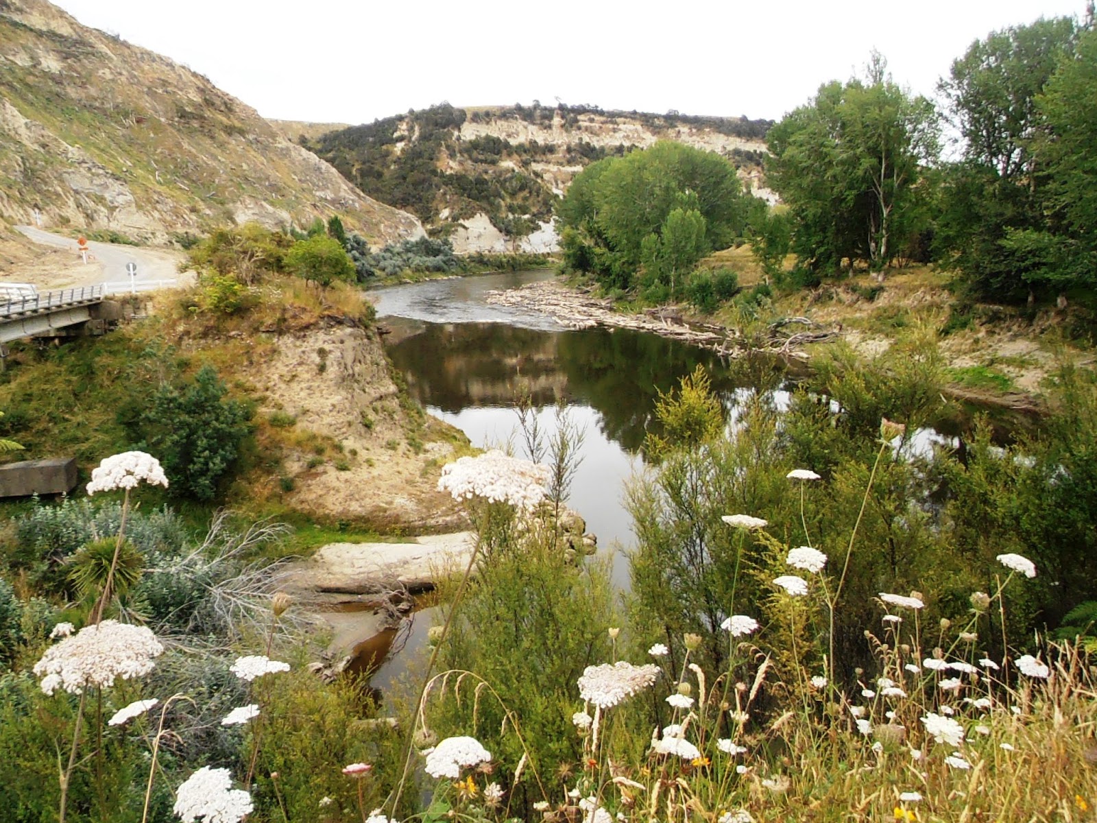
Wanganui River from the Aramoana viewpoint
Instead of returning toward Wellington and heading north on Highway One, we drove up over “the Haywoods” coming down onto the west coast at Paremata, then continued on north after shopping for fresh bread for lunch and the Wellington newspaper, which we decided is not a whole lot better than the Christchurch Press; perhaps even worse because at least two of the feature articles had been published two days before in the Press. 

Our journey saw us meander slowly up the North Island with plenty of time to return to our home base. The weather did take the shine off some our tikki-touring, but there is not much one can do about that apart from remarking from time to time that we thought we had left the lousy weather down in the South Island.

On a whim we decided to come up the Wanganui River Road, a road untraveled since it has all been sealed. The sixty four kilometre road which follows the river from just north of Upokongaro on State Highway 4 as far as Pipiriki was first opened in 1934 and took thirty years to construct. Since then nature has made sure roadwork teams have been kept busy; more recently after the floods of mid-2016. When we drove south almost three months ago, then travelling on the Parapara Road which was beset with devastation during the same weather events, this lesser road had been spent periods of time totally closed and others open for limited periods. Fortunately for us, now months on, the road was passable, although still pitted and pot holed, narrow, slumped and slipped.

A sleepy section of the river
We stopped at the top of the one real hill along the way, the Aramoana Viewpoint. I have taken photos from this very spot throughout the years, and am never bored with the view. The Wanganui River at this lower reach is more sluggish than further up where there are untold rapids that challenged the riverboats in the first part of last century, and these days thrill and excite the canoeists and jet boat travellers. 

Roadside pigs
There are numerous maraes all along the route, evidence of a strong Maori presence in years gone by, long before Europeans settled upriver themselves. While some of the whare nuis have disintegrated into the landscape, some have been restored to their previous glory and are in use for locals or those who are invited. Naturally we did not fit into either category. There are still Maori families who live along the way, and others who live in the same casual manner, as was evidenced by the number of pigs loose in domestic gardens and in a couple of instances, all over the road.

There are also a couple of Catholic Churches, one at Ranana and the other at Hiruharama / Jerusalem, this latter home of the recently beatified Mother Marie Aubert and later to poet James K Baxter and his hippy cohorts. In fact that community did not close until after Baxter’s death in 1972. There are still nuns and the like wandering about the place or at least there were when we called up to the convent ten years or so ago. The church features a beautifully carved altar in Maori design and kowhaiwhai panels adorn the walls. Once the home of an orphanage where little Maori children were converted to Catholicism, and hopefully nothing else, the convent now hosts retreats. 

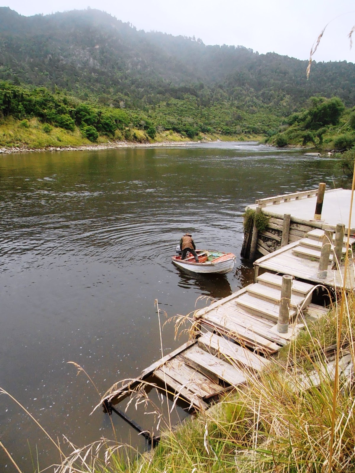
A local about to head upriver
Not too far from Jerusalem is Moutoa Island, the scene of a short and fierce battle in 1864 between Wanganui Maori and an invading Hauhau force. The battle helped to establish a close bond between local iwi and European settlors. The battle has been memorialised with a monument in the Moutoa Gardens down in Wanganui itself.

We arrived at Pipiriki by lunchtime and parked up just above the wharf where a local man had just arrived with his son, daughter and grandchild in his dinghy. We learned that he lives upriver and the only access is by boat. The rest of the family were heading back home, wherever that be, after spending part of the summer with him in isolation. We watched as he headed back up river; he was a taciturn type, well suited to his otherwise solitary life.

Today Pipiriki is gateway to the upper Wanganui River and all the adventures that tourists enjoy thereon and thereabouts, but once it was an important staging post for the paddle steamers that plied the river with cargo and passengers. My mother remembers the hotel that stood grandly above the wharf, hosting those like her family who were obliged to pause their journeys here before taking smaller vessels upriver. The hotel burnt down in 1959 and is now only a memory and part of the paddle-steamer history of the river and the entrepreneurial Hatrick family.

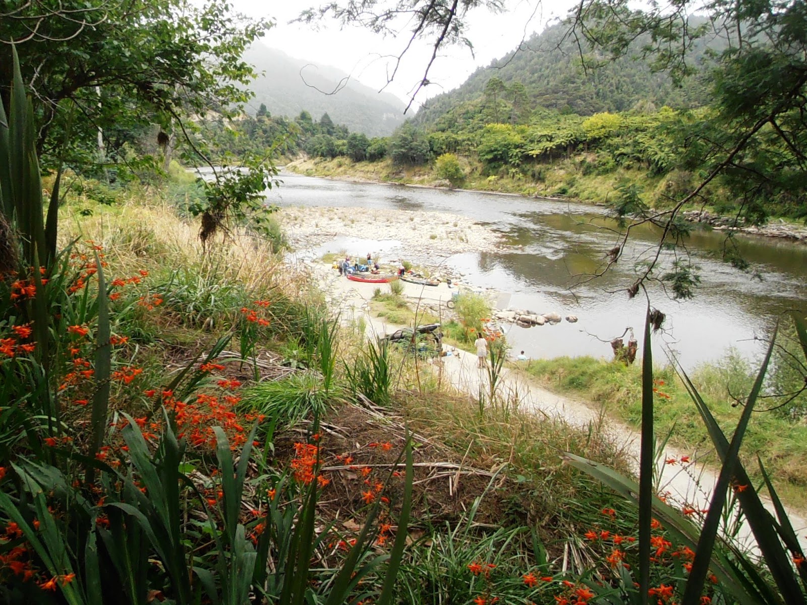
Arrival of canoeists at Pipiriki
We watched canoeists straggle in off the river, some wet from having been tossed out in the rapids immediately upriver. The plastic barrels being unloaded reminded us of our own river journey taken about eighteen years ago, and while I remember it fondly, particularly the fact that Chris and I did not capsize our Canadian canoe, I would not like to tempt fate by trying to relive the experience. 


From Pipiriki, we travelled eastward back to Raetihi on a better road, twenty eight kilometres up through high dense native forest, many of the aged trees bedecked with Old Man’s Beard moss.  Pungas and manuka grow down to the edge of the road and where repairs had cleared the edges, Himalayan Honeysuckle is taking over. We continued on the short distance to Ohakune where we camped up Mountain Road at the Mangawhero DOC camp, one of only four parties for the night. The weather had turned as we came away from the River, and by nightfall, rain was falling steadily.

Unfortunately the morning was little better and we ditched our plans to walk The Old Coach Road at Ohakune. This is a fifteen kilometre walkway, now part of the Mountains to the Coast cycleway, this part from Ohakune up through to Horopito, which lies 150 metres higher than Ohakune’s 610 metres ASL. We were keen to do the first section to take in the views of Hapuawhenua Viaducts. The Old Coach Road formed an integral link between the two rail heads between 1906 and 1908 before the Main Trunk Line was completed. Alas it was not the day to see this for ourselves; the clouds were low and the temperatures low and mountain weather can change at the drop of a hat. Next time hopefully!

Makatote Viaduct
And so we came on north sooner than expected, on past National Park, the central mountains and paused for morning tea beside the Makatote Viaduct, which is still very much in use today. This is 79 metres high (the third highest rail bridge in New Zealand) and 262 metres long, built between 1905 and 1908 by a Christchurch crowd, although the steel was actually fabricated on site. This viaduct, the last structure on the line to be completed, has always impressed me, ever since I first passed this way as a small child, but now it looks even more impressive with its new red iron-oxide coat of paint.
We were delighted to find ourselves only the third ever party to overnight at the NZMCA’s brand new park over property at Otorohanga, adjacent to the Waipa River. Right now it seems an absurdly large area, but no doubt as members learn of its existence, it will become as popular as Ardmore or Taupo. After dinner, as the starlings settled down to roost in the boundary trees, we watched the changing skies as the sun disappeared beyond the horizon, the horizon lying in the direction of Honikiwi, the rural area I spent the first nine years of my life. I thought it quite fitting that we should be among the first here at this park, when it was this very town that had been “our local” as I spent those formative years.

Further north on our journey, we detoured to Lake Puketirini on the western edge of Huntly for the sole purpose of exercise. We had happened upon this recreational lake a few years ago after driving up from Kawhia through the mining area. This time we were intent on walking its perimeter.
The lake is a relatively new feature of the township, developed from a disused coal-mined pit and ready for use in 2007. The Waikato District Council owns the park and promote its existence for use such as kayaking, water-ski-ing, boating, waka ama and of course walking. 

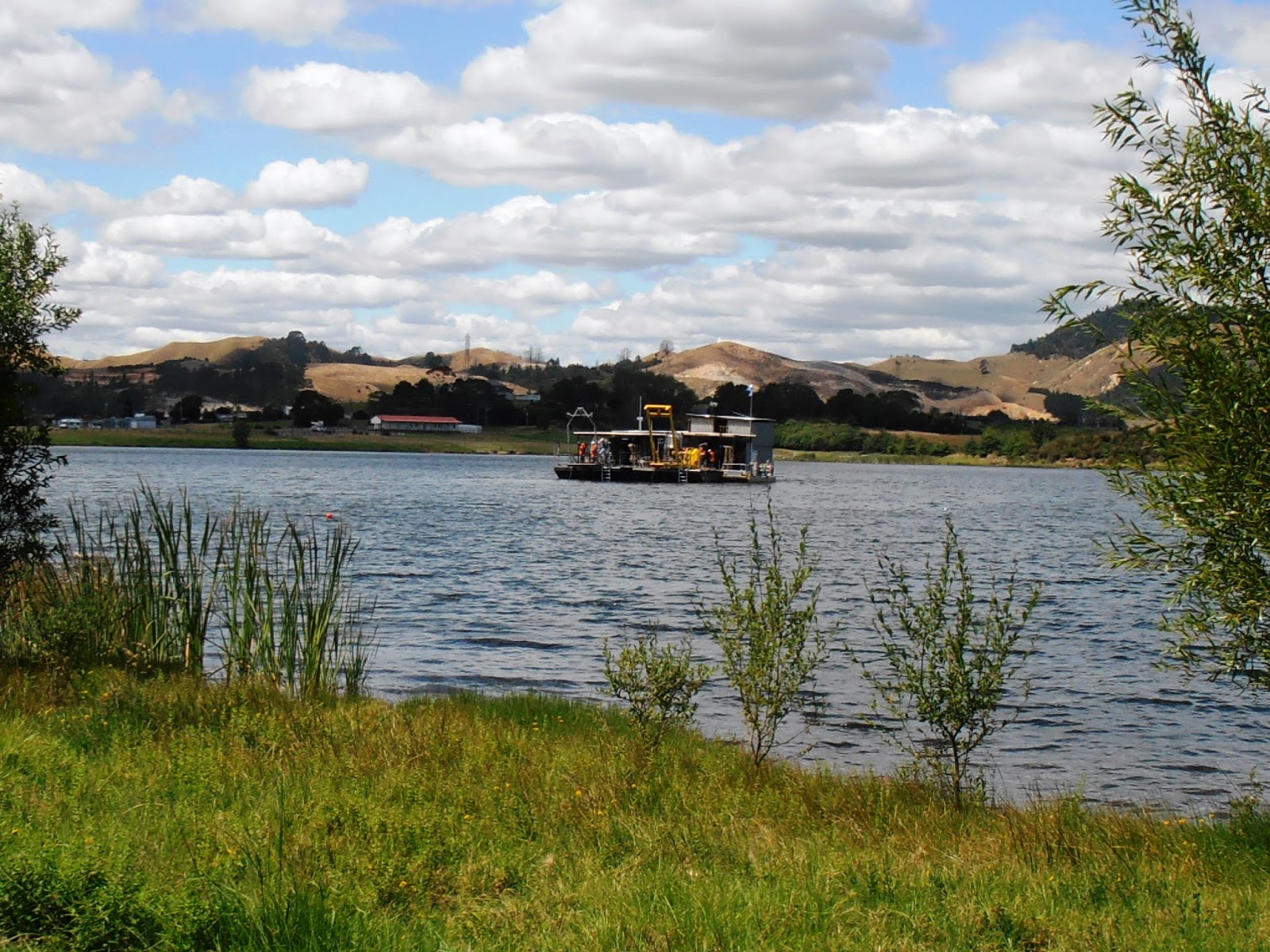
Huntly's diving school
En route, we came upon a Scotsman with three very boisterous dogs, and fell into conversation with him after the dogs had settled down from their excitement about us. There is a large diving platform in the centre of the lake and we were curious as to its purpose, given that it more like dredging equipment. It turns out that this is the operational centre for the New Zealand  School of Commercial Diving, which according to the local dog-walker, charges about $40,000 for a six week course, and if you graduate from here you have one of the best diving qualifications in the whole world. Further checking did substantiate the fact that the school offers courses internationally and you can graduate with a screed of letters after your name, however the training time and cost must be left as hearsay only.  This same man told us that the water in the lake is very clear and that mining machinery was left in the bottom of the mine which serves the same as shipwrecks for the learner divers. True or false? It’s a good story anyway.

As we passed through Auckland, we did a drive-by of the house we worked on last year before it was sold; the property we had restored the driveway by hand, blood and guts, had the fence repaired and generally restored the tidy little house standing on a large corner section. We were appalled to discover that a tiny little brick residence has been squeezed onto where the driveway was, not only negating all the hard work we did, but surely creating one of the ugliest little unliveable homes in the city. We guessed the new owners were reaping the greatest rentals from this now double producing property, and most likely far in excess of double what we had earned ourselves. In fact we would guess they are earning five times as much! We were shocked, numbed, although glad to have rid ourselves of our troublesome South Auckland investment.

We have been “home” for a couple of days now. Our motorhome is set up on our bush boundaried sea view section “Jumbo” (our white elephant for those not in the know). The weather has been warm and sunny, quite tropical and a far cry from that experienced over the last couple of months. We have yet to catch up with all the family, but have managed to book our air tickets for our next stint in the UK. In the intervening ten weeks there is much to be done, not least the wedding of my niece to attend and a boarding school reunion, the get together of a gaggle of sixty-somethings after a separation of fifty years. We do intend to get away travelling at least once more before we head overseas, even if it is simply to attend that dubious reunion. (I dare to say “dubious” because I am always wary of social gatherings and it will require courage on my part to walk into the room, although I know in my heart of hearts that it will be an absolutely brilliant “homecoming”. The anticipation of reunions is the scary part.) In the meantime I shall languish in the humidity and not complain at all!

Sunday 5 February 2017

5 February 2017 - Petone Working Men’s Club


We were away from our racecourse camp early yesterday morning, and even after dumping and filling with water, across at Havelock an hour before our rendez-vous time with my cousin and his partner. Greg and Jenny have lived in the idyllic seaside village of Havelock for nearly twenty years and this was to be our first visit, despite having driven past their home at least half a dozen times in the last decade. We spent an hour and a half describing our families, admiring the décor and discussing the frustrations of life over a pot of tea and then it was time to go. They were keen to see our own little “home” and while they were full of admiration, they probably wondered how we could live so many years in such a tiny space. Some things are best left unsaid; however we did express our desire to call in again when we were next this way, and I had no reason to suspect their reciprocated murmurings were anything but sincere. 

The last of the sunshine on Ngakuta Bay
So we pressed on beyond Havelock, this time on the Queen Charlotte Drive, the winding road that hugs the coastline and offers the spectacular views firstly into Grove Arm and then into the upper reaches of Keneperu Sound, particularly on such a glorious sunny day. We slowed down by the DOC camp at Aussie Bay and agreed it looked too intimate to accommodate a vehicle such as ours, and then pulled into that at Momorangi Bay, which looked more like a commercial motorcamp than a DOC camp. We parked and started for the office, noting the per person tariff and thought we had better check our DOC camp literature, now suspecting it to be one of the serviced camps that are excluded from our annual pass. Finding it to be so, we left without further enquiry, but did ring ahead to a POP further along the road. 

At Ngakuta Bay we were welcomed  warmly by Judith and Gary who offer association members powered or unpowered sites at an absurdly low tariff, one which we topped up to a more realistic level. So we plugged in and spent the afternoon relaxing, reading and enjoying the surrounds. Up in a little valley, the birds sang of their joy for the fine weather, undeterred by the few vans occupying the grassy paddock.

Later after dinner we wandered down to the bay and found the place a hive of activity; families playing after-dinner tee-ball and cricket, families paddling about in kayaks, some with lifejackets and some without, children fishing off the jetty with lines and nets. The sun was already low in the sky, its rays only kissing sections of the bay. It was quite lovely and I regretted that we did not walk out after dinner often enough.

Children net-fishing at Ngakuta Bay
This morning we headed off in a leisurely fashion, after heartfelt thanks to our hosts. We were a mere 11 kilometres from Picton so were soon there, even though we paused at the lookout high over the bay. Once parked up we spent a couple of hours wandering about the charming little township, bubbling with activity as it must every day during “the season”, because the ferries come and go whether it is the weekend or the weekday, school holidays or not. The bright sunshine made for more vibrancy and brought those waiting for the ferry out onto the esplanade.

We discovered the National Whale Centre on the waterfront, a mini museum of New Zealand whaling history with interpretative displays, films and literature for sale. Panels explained how the Marlborough Sounds was the epicentre of 19th and early 20th century whaling enterprises, and that for nearly 140 years, whales on their annual migration north were sighted by whalers from hilltop lookouts at the entrance to Tory Channel.

Overlooking Picton
We found it quite fascinating, even more so because there was mention of the local Norton family who one of my cousins married into, who with fellow descendants of the first whalers were still amongst the crews of the whale-chasing boats when the shore stations finally closed after nearly a century and a half. I recall Tom Norton speaking of those whaling days at my father’s eightieth birthday celebration.

Our sailing was uneventful despite the wind and the sea I felt rise and fall beneath the vessel whenever I stirred from my seat. The rest of the time I reclined comfortably in the on-board cinema, dulled by seasick tablets and the mindless comedies shown, the sort full of kindergarten potty humour. However I was pleasantly roused from this stupor by the announcement of our arrival in Wellington, and felt better than I had during and after all such recent marine journeys.

The arrival in Picton of the Bluebridge Ferry
We rang ahead to the Club and were told that while the car park was busy, there would be room for us, however on arrival found this not to be so at all. We parked some distance away, then came across to the club to dine and be entertained by the live music and dancing before retrieving the camper and moving into this now slightly less busy spot. I imagine the next hour or so will see the car park empty out and we will be left pretty much alone.


Friday 3 February 2017

3 February 2017 - Waterlea Racecourse, Blenheim, Marlborough


We left our busy little camp beside the Brown River long after most of our fellow campers had moved on. Chris spent a good part of the morning drawing water up from the river with a bucket at the end of a rope, rinsing, shampooing and rinsing again, our motorhome scarred from the previous day’s onslaught. Alas he was unable to climb up onto the roof, so for now the solar panels and satellite dome must remain covered in a film of salty grime.

Views from the Wairau Lagoon to Wither Hills
I had wanted to stop at Pelorous Bridge and redo some of the lovely little walks that are on offer, then again wander about quaint little Havelock, but the rain continued to fall and stopping did not seem to be an attractive option. From Havelock we drove south to Renwick, an almost flat run through a wide valley, grapes and garlic the obvious crops as we neared Renwick. There we turned north again to Blenheim and came through to the racecourse, a well tried and true camping spot available to NZMCA members. Unfortunately the tariff has gone up to $10 per van per night, but there is now a dump, and a more conveniently placed water tap, so I guess all of that costs and needs to be covered by the users.

It was a delight to wake to blue skies this morning and the hope we could spend a full day doing fun stuff, apart from doing a small load of laundry. Mind you, doing laundry and hanging it out in the sunny breeze makes for domestic happiness.

We headed early into town and caught the 10am session of one of the latest movies, “Manchester by the Sea”. To say we “enjoyed” it would not be strictly true; it is a dark tale, but well told and well-acted, to be recommended, but enjoyed ?  

Across the wetlands toward Cloudy Bay
After lunching late, we headed out to Riverland, on Highway One, the way to Seddon and Ward, previously the way to Christchurch in pre-Kaikoura-earthquake days. We turned up toward the Wairoa Lagoon and walked out across the wetlands to the wreck of the S. S. Waverley. The signage is appalling so it was not until we returned “home’” that I was able to find anything more about this rusting hulk. Apparently about eighty years ago, the Waverley was towed from Wellington by the SS Wairau to the mouth of the Wairau River where she was to be sunk to form a breakwater. Before being scuttled, she was swept up the channel in a flood to where she now lies, in the Wairau Lagoons.
The wreck of the S S Waverley
The three kilometre path across the flat reserve to the wreck starts with a small pathway between the settling ponds of the sewerage works. But like all developments like this these days, there is little to remind one of the less pleasant aspects of the process. 

Here there are 3,000 hectares of water, shoreline and adjoining land now regarded as the most important coastal wetland between Golden Bay and Canterbury. Along the lagoon banks there is evidence of past residence when the early Maori used this as a productive food bowl. Moa once populated the area before they were annihilated by the first occupants of this land of ours.  Today it is a breeding ground for birdlife and other wetland creatures, but alas, the moa are well and truly gone.

It was hot and windy out walking, but exercise much appreciated. Returning to the racecourse, we stopped off at the Scottish restaurant for ice-creams, shopped at the supermarket, filled our diesel tanks and on our return found the washing well sun dried, a first for quite some time.


Thursday 2 February 2017

1 February 2017 - Brown River Reserve, Rai Valley, Marlborough Sounds


Cattle along the way
On waking there were more vans in than the night before, however none jammed up against us as we seem to have endured so often of late. The skies were low over the Bay but we were optimistic that as the morning progressed visibly would improve. Alas, we were so wrong. We drove up out of Elaine Bay and headed north toward French Pass, mainly driving along a high ridge at first along a wide gravel road bordered with scrub. The map suggested there were views to be had to the left and right as we passed along narrow peninsulas, and a couple of narrow tracks led off to the side down into bays that may well have been picturesque had we been able to see anything. Alas the cloud was low, swirling about us, sometimes so dense we had mere metres clear ahead of us, and sometimes a little more. A sign on the roadside warned we would be passing through farming land where livestock wandered randomly, so we proceeded with care, coming suddenly upon a small herd of beef cattle fairly nonchalant about the through traffic. 

View over Anaru from Collinet Point
After about ten kilometres we crossed a cattle stop and were suddenly into well managed farmland, and so this continued right through to the end of the road at French Pass. Much of this land is owned by Te Kuta Station, who run Angus cattle and sheep on the absurdly steep hills of this spectacular country, or at least spectacular where it can be seen to be so. I ran a commentary when glimpses of bays far below the road could be seen, while Chris concentrated on the very winding road high above the sea level. Soon D’Urville Island came into view, just across the stretch of water known as French Pass. While this is part of the seas that make up the Marlborough Sounds, it is more like a wild tidal river, which allows a narrow pass between the shallow rocky part reaching out from the island and the mainland. It apparently has the fastest flows in New Zealand reaching eight knots, and when the tide changes, the current can be strong enough to stun fish.

French Pass, D'Urville Island in the distance
It is here at Collinet Point, above the Pass, that the famous Pelorous Jack is celebrated by a statue. We stopped here and braved the winds to look down upon this dangerous section of navigable water.  In 1888, a Risso’s dolphin appeared for the first time and continued to accompany boast to and from French Pass for the next twenty four years. He became the first dolphin in the world to receive the protection of the law, and was last seen in April 1912.

From this view point the road descends steeply into the little bay on the edge of Admiralty Bay where there is an intimate DOC camp for which forward booking is essential during the summer months, a wharf and a few houses, most part of the European farming community that has been here for the past one hundred and sixty years.

Hanging about Anaru / French Pass
Despite the relative shelter of the bay tucked around the corner from the pass, gusts still buffetted the motorhome we parked parallel to the beach. We decided to wait the weather out, sure that the wind would blow the low cloud away by early afternoon. And so we read and watched the occasional marine traffic, occasionally rocked by a mighty squall of salt water. By 2 pm, there was little improvement but we were optimistic that matters would be better once we climbed back up above sea level. Alas, we were wrong. The cloud was even denser than the morning’s run in and we crawled back toward Elaine Bay at 20 to 30 kph, buffetted by dust laden wind, with visability little more than ten metres. Sheep appeared from nowhere, and oncoming traffic only visible when their lights were right upon us.   

We pressed on, regaining the sealed road on reaching the turn off to Elaine Bay, still proceeding with caution, on back past Okiwi Bay back out to the main road, sixty kilometres from French Pass. By now serious rain had set in and we backed in beside the river, at this point with only one other camping companion. However by the time darkness fell there were nearer twenty little whizz-bangs vans and one other large van, all squeezed in with no regard to the safety requirement for a three metre gap. A quick exterior inspection of our van proved it was dirtier than it had ever been in the entire time we have owned it. Chris is rather upset.